Skip to main content
Q-Album
Toggle navigation
Main navigation
Places
Themes
Time
Map
About
Search
Search
Rivers
Show advanced filtering options
Townsville and Harbour
Stanley Street, 1873
Looking along the Brisbane River in 1885
Petrie's Bight, 1889
Garden Reach, from Alice Street Ferry
Brisbane Skyline
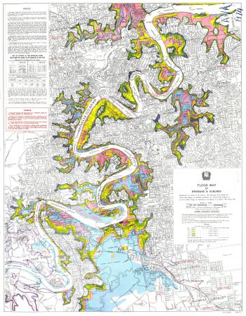
Flood map of Brisbane and suburbs, delineating the extent of the January 1974 Brisbane River flood
Brisbane, c1989
Southbank Beach, Brisbane, 1992