-
Contributor

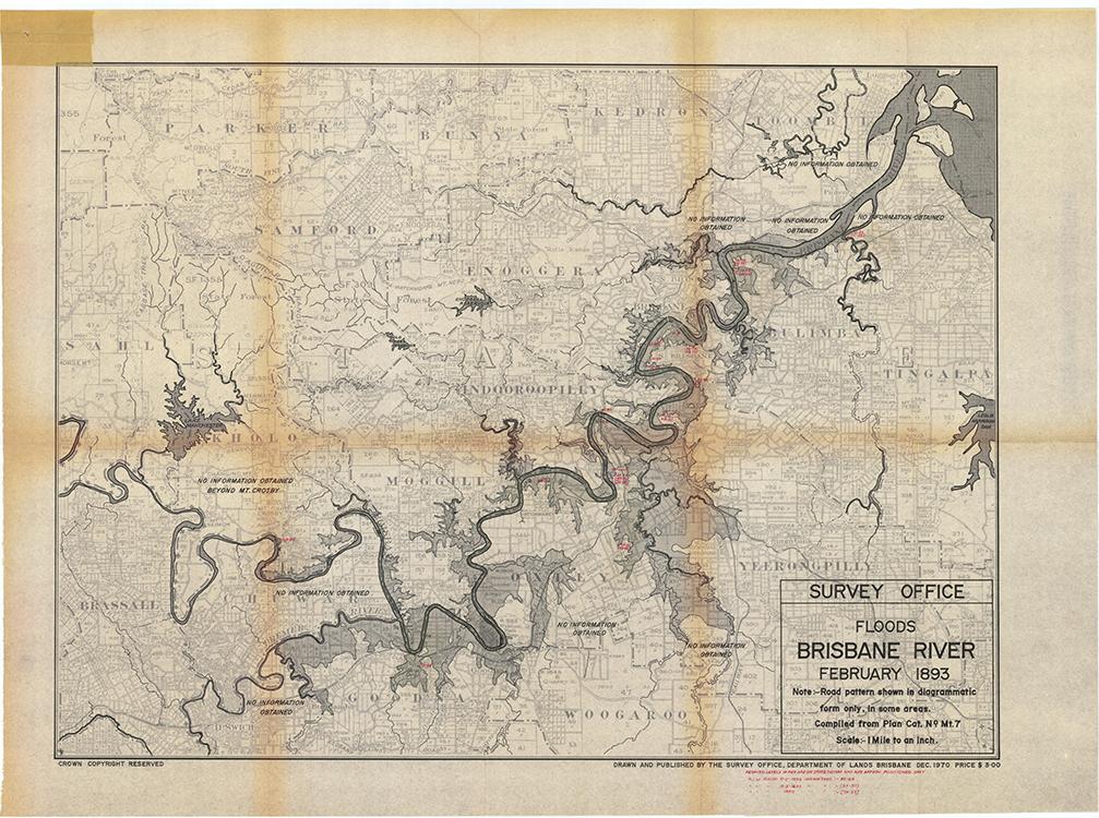
In early February 1893 Brisbane experienced the worst floods in its recorded history. By 4 February an estimated 2150 millimetres of rain had fallen in the catchment areas of the Brisbane River, with the situation intensifying after a cyclonic disturbance struck the coast. Queensland's entire south-east corner as far north as Rockhampton was affected by the wild weather.
Flood waters reached their highest peak on 6 February, when between four and six metres of rain covered the main thoroughfares in Brisbane's central business district. At the height of the flood the iron railway bridge at Indooroopilly and Brisbane's Victoria Bridge were washed away, and the Queensland Government gunboat, HMQS Paluma, was left stranded in the Botanic Gardens. The vessel was refloated during another flood a few weeks later and it was not until 21 February that further threats were removed when the cyclonic disturbances finally moved offshore. Among the victims of this natural disaster were seven coalminers who were trapped underground when floodwaters raced through the North Ipswich Mine; their bodies were recovered weeks later.