Plan of Brisbane Town
Background

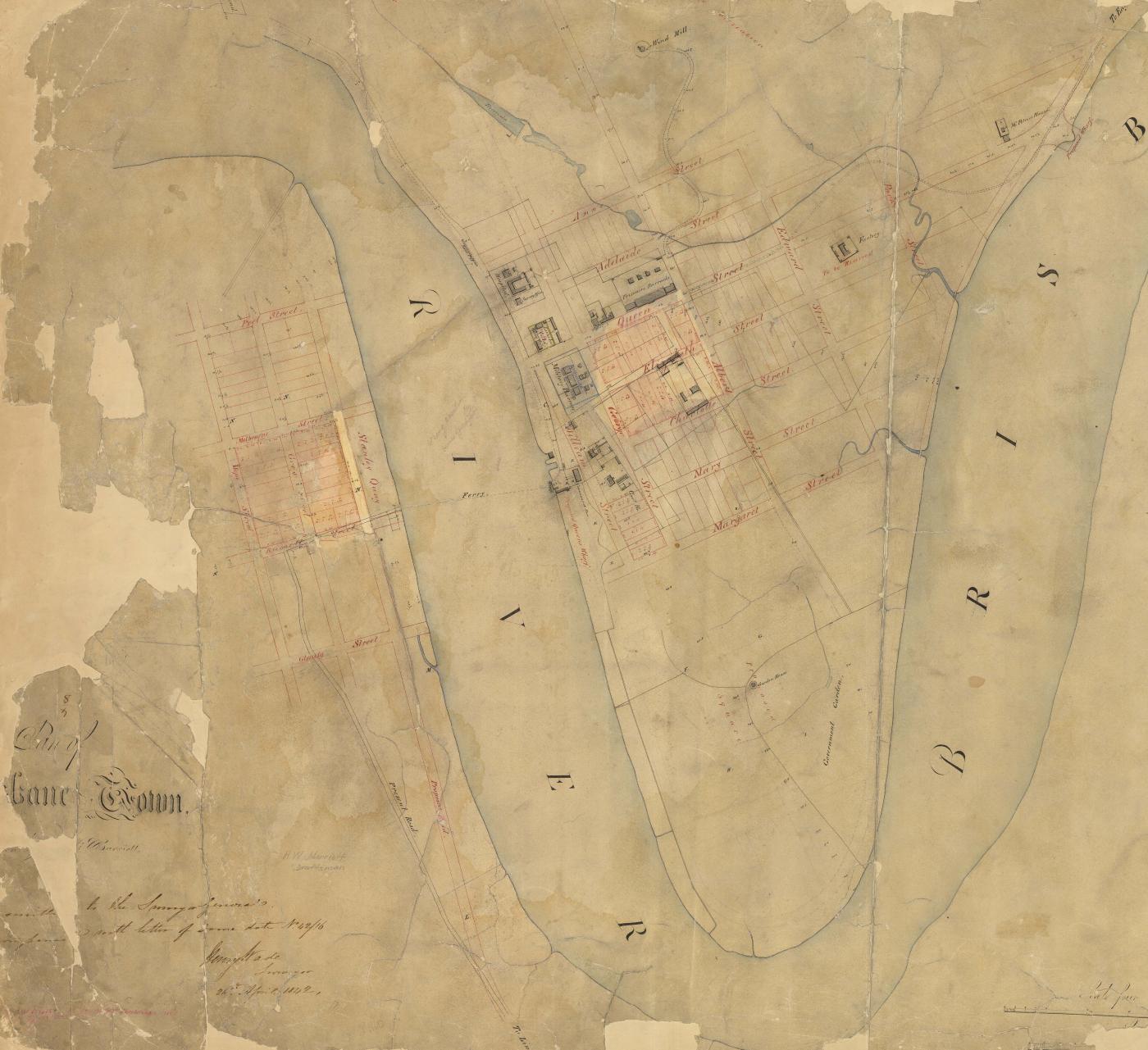
With the opening of Moreton Bay for free settlement in 1842 the north bank of the Brisbane River began developing as an urban centre. The Chief Surveyor at Moreton Bay, Henry Wade, prepared a plan of the townsite in which the present central city area was formed into a series of square blocks, but this was altered to make them rectangular. After Governor Sir George Gipps visited the settlement in 1842 a number of streets were also reduced in width. By 1844 there was still only one general store, though other commercial business included two milkmen, a sawyer, a butcher and a blacksmith. There were also two hotels, Wright’s and Row’s, and as could be expected of a frontier town, Brisbane society was predominantly masculine. Law and order was both rough and very public, with floggings being conducted in the main thoroughfare of Queen Street until 1847; hangings continued as a public spectacle in Queen Street until 1855. The dominance of Brisbane’s northern bank did not go unchallenged, however, for, for during the 1840s both Cleveland and South Brisbane competed for supremacy.  By the end of the decade it was nevertheless clear their efforts had been in vain, as shipping was largely using the wharves on the northern bank of the river and the accompanying commercial growth signified that this area would be the hub of the future colony.


Discover more