-
Contributor

- Background
-
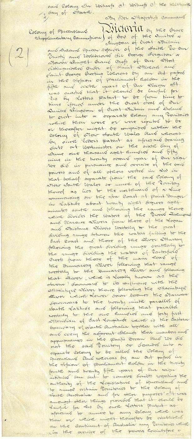
When Queensland was proclaimed a separate colony in 1859 the western border was vaguely described as lying at the 141st meridian and extending southwards from the 29th parallel. As Surveyor-General Augustus Gregory was well aware Queensland was thereby deprived of the potentially rich pasture lands existing on the Plains of Promise, below the Gulf of Carpentaria, discovered by Captain John Stokes of the Beagle in 1841. Gregory therefore suggested that Queensland’s border should be extended west to the 138th meridian, thus embracing these pasture lands on the upper Albert River. Governor Sir George Ferguson Bowen agreed, advising the Colonial Office that the Queensland Government was prepared to take responsibility for, and provide protection to, future pastoralists in these northern districts. His proposal was accepted on the proviso that the additional territory could be reclaimed if a new colony was established in northern Australia. The Letters Patent were issued on 12 April 1862, and the territorial gain was to bring long-lasting benefits to Queensland far in excess of that envisaged through pastoralism. Unbeknown at the time, the extension westwards included the valuable mineral fields of Cloncurry, Mary Kathleen and, even more importantly, Mount Isa and surrounds.